

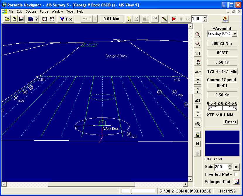
Portable Navigator is a chart plotting and data logging system for navigation and survey use for hydrographic and terrestrial applications. It can be run on the smallest Notebook PC for workboat use or larger desktop systems. Portable Navigator is ideal for survey work because it enables users to create and update their own detailed vector charts and to quickly lay down track lines for navigation coverage of the area to be surveyed. Following track lines is now easier than ever with heading up display, perspective chart views and automatic Steering Waypoints. These are two waypoints at "infinity" which auto-change when turning at the end of each track line enabling you to use an autopilot in addition to visual steering to follow a survey grid.
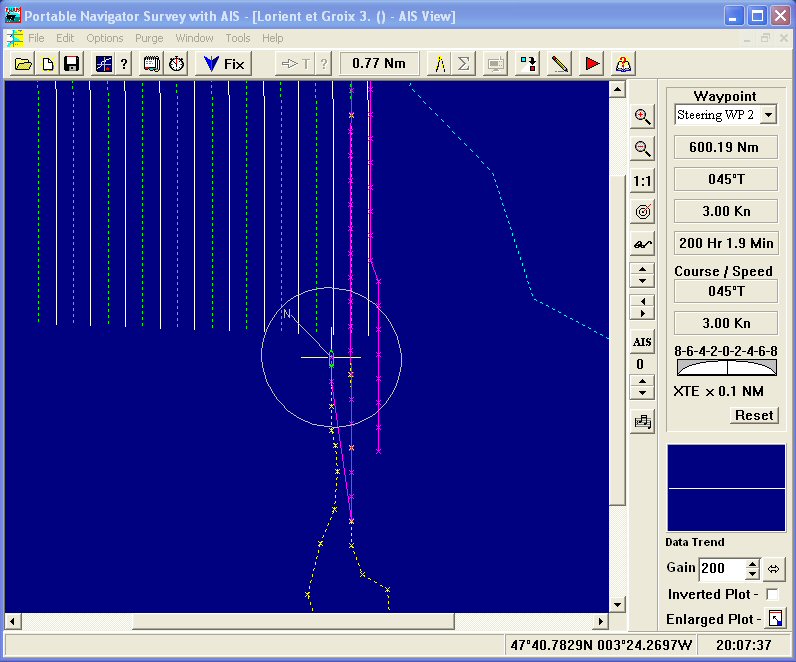
PN will interface with any GPS receiver system that outputs NMEA 0183 or other data. Using NMEAProIII ESL's DDE NMEA server it is able to log multiple channels from a variety of sensors and display the data in various formats to facilitate visualisation. Up to four views with different display characteristics and data can be opened simultaneously. Following track lines has never been easier with the new perspective chart view.
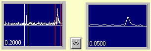
Use Data Zoom to quickly find the location on the sea bed of interesting data anomalies. Automatically create a waypoint on the chart at the position of interest.
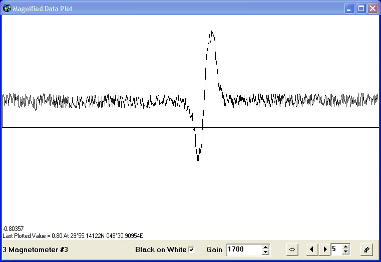
The new Data zoom magnifier now plots the logged data in a separate window with measurement facilities. This large plot window makes Data Zoom easier to use for seabed object location and instant creation of chart waypoints at that point for future diving investigations.
Insert event fixes with remarks, data plots and screen shots directly into an MS Word document file in real time, pre-preparing the survey report while still surveying, saving time on post processing.
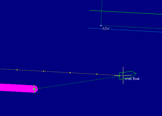
Another unique feature of Portable Navigator is the Vessel Plan display and the Antenna Offset facility. This enables the survey vessel and it's tow to be displayed schematically on the chart for the accurate representation of the position of towed sensors even when logging data in cross tidal situations as shown above. This example shows a 10m workboat with a 50m tow and a 4m wide coverage swathe. There is a 0.6 Kn tide set 170deg T, which at the slow speed of the workboat, 3kn, causes an offset of the towed magnetometer's position. This is automatically calculated by PN and the estimated towfish position is logged (green dot at the end of the dashed green line). The yellow dashed line is the track of the GPS antenna on the workboat, while the thick purple line is the coverage swathe plot for the transducer. Note that the actual towfish position is offset by more than 10 metres from the track of the workboat! For future location of seabed features by diving this sort of accuracy is essential.
Fully integrated optional display of AIS targets and data with separate windows for AIS Target Data and New Video Output Blackboard with any required data displayed on main or secondary monitors. Or on any connected mobile device on the ship's Wi-Fi network
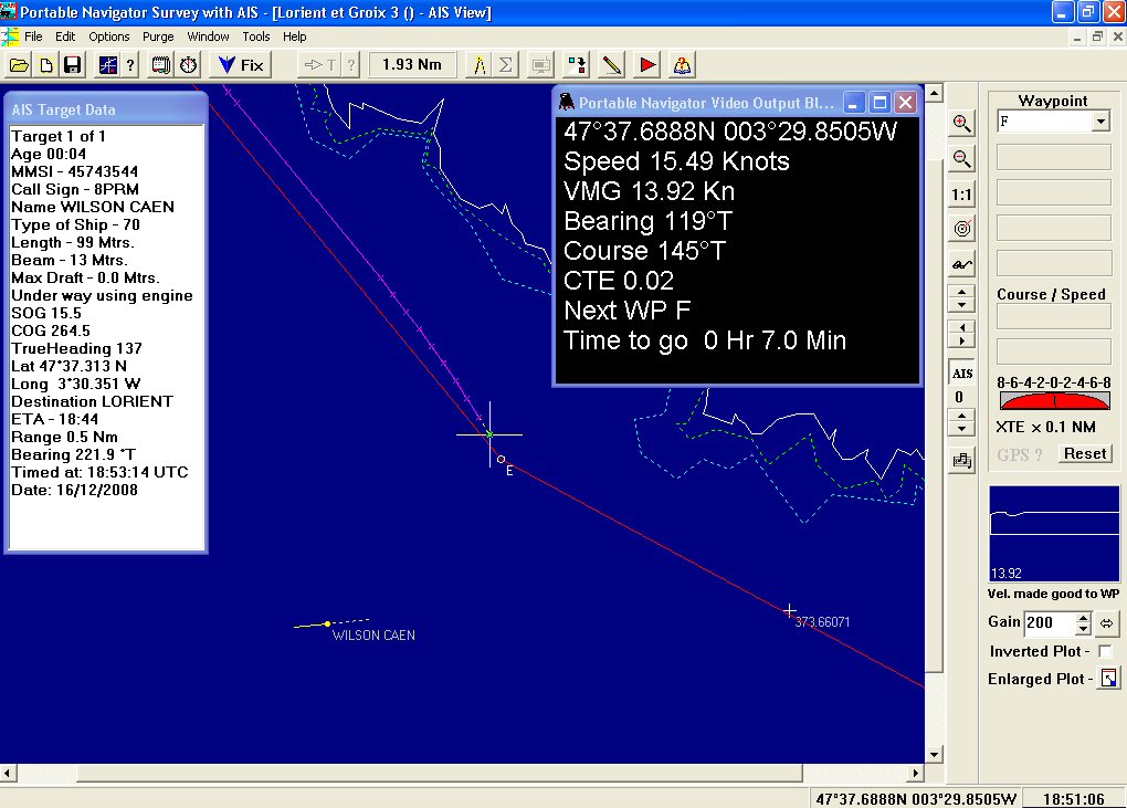
In addition to the advanced data logging facilities provided by Portable Navigator Survey 7.2.5, the latest version of Portable Navigator, has AIS based collision potential analysis.
The results of the AIS based collision potential analysis are displayed in the AIS Visible Targets List. Every time the list is updated the visible targets are analysed for collision potential by looking at changes in the target's bearing, the result being displayed in the left column, headed Passes. The range of target for analysis and the auto list refresh time can be set. The default values are Range = 5 Nm and Auto Refresh Rate = 30secs. If a target is outside the range, anchored, moored, stopped, aground or your own speed is 0 then the analysis is not carried out and a " - " is placed in the Passes column. Other possible Passes status results are: Danger?, Ahead, Astern and Passed, the latter being when the distance of the target is increasing between list refreshes. This is the same process as using a hand bearing compass when crossing shipping lanes but automated using AIS data to provide better security.
AIS Monitoring and Fleet Management
VTS and Coastguard use for vessel traffic monitoring and fleet management using the AIS monitor mode. The unique AIS log enables the recorded traffic patterns to be analysed for marine incident investigation. For fleet management the built-in AIS Target database enables fleet members to be tagged and instantly highlighted and flashed in the AIS display for ease of locating related vessels in a busy port. Use of this feature could include Tug Fleet tracking and dispatch.

Optional Vessel Lights, based on the AIS navigation state of each target, can be displayed to further clarify the traffic pattern and possibly assist with incident analysis. Watch the video demonstration of this feature (opens with Windows Media Player).
Portable Navigator supports multiple chart views, each with individually configurable content and display characteristics. There is also a data trend plot for the main window to enable the selected data channel to be visualised as it is being collected or off-line for analysis. The data is logged to simple comma delimited text files, the format of which is specified by the user. This makes the exporting of data to other applications such as spreadsheets very easy. Portable Navigator provides full file compatibility with all of it's earlier versions.
Recommended minimum hardware : 1.5 - 2 Ghz Pentium PC, 2 Gb RAM, 200 Mb Disk space, COM or USB port. If your PC only has USB ports you can use a USB to COM port converter cable for use with serial NMEA devices. Or use a USB GPS or AIS receiver. We have tested this software with UBLOX USB GPS receivers and with many other USB 2.0 - DB9 adaptor cables. Both GPS and AIS receivers are available as small dongles making Portable Navigator truly portable NMEApro III now auto-detects the COM ports present.
Operating systems: Windows Vista, Windows 7, 8 and 10.
Why not find out more by downloading the HTML Help file ?
(Problems reading this help file? Click here)