Application Note 3   >>> 4

Nessie Dredging Display and Data Logging System

The Uned Amddiffyn Yr Arfordir / Coast Protection Unit of the Cyngor Gwynedd Council use a custom system based on Portable Navigator and NMEA Pro together with a special hardware interface and multiplexing system to monitor the dredging operations in Pwllheli harbour, North Wales.
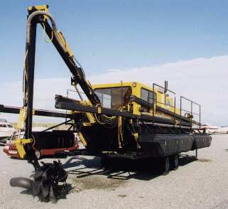
The "Nessie" Dredger, (left), is equipped with a Trimble 4700 based Survey grade DGPS system which, as well as position, can measure the antenna altitude to an accuracy of a few mm. The joints of the dredgers hydraulic jib and stick are instrumented with clinometers to measure the angles.

The clinometers are connected via a specially adapted NMEA multiplexer to a Notebook PC in the dredgers cab, running a custom version of NMEA Pro, which polls the clinometers for angle data. This together with the position data is sent to the ESL Nessie Dredging Display and Datalogging program.
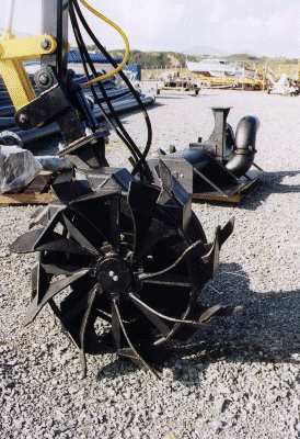
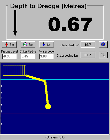
The display program enables the operator to set up the machine dimensions such as the radius of the cutter head in use. It displays the angles and the depth of the dredge, calculated using the antenna height, the datum seperation and the instantaneous machine geometry.
The ESL Display Software also provides a mimic diagram showing the positions of the arms and cutter, which enables the operator to continue dredging in conditions of poor light and visibility. All parameters are logged together with time and date, so that the dredging operation can be analysed afterwards by exporting the data to a GIS system. This enables progress against the dredging plan to be monitored and further plans to be made.

>>> Next

Return to the ESL home page.