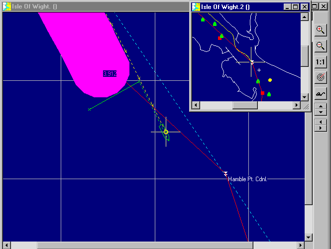

The screen shot below shows a typical display for a 50 metre towed side scan sonar with a 60 metre coverage to the right of the track. The GPS antenna is at the large yellow cross. The small yellow circle around it is the estimated position error, in this case only about 2 m. The yellow dashed line with small yellow crosses is the track of the antenna - note this is offset in the vessel in this case being on the starboard side of the wheelhouse roof. The green dashed line shows the tow and, the solid green section at rightangles to the track, is the extent of coverage. The thick magenta "line" shows the area or swathe of the seabed already covered.

The position of the centre of this swathe can be sent back to the sidescan equipment to annotate the chart. Also this position, together with the tow-fish position and the extent positions can all be logged in Portable Navigators survey log, the format of which is user programmable using the Parser. Having all these positions recorded makes the job of relocating objects of interest as dive targets much more certain.